


Civils.ai
An AI co-pilot for construction projects. Sync your project documents with civils.ai to instantly find information, answer questions and extract data from construction reports.
Definition
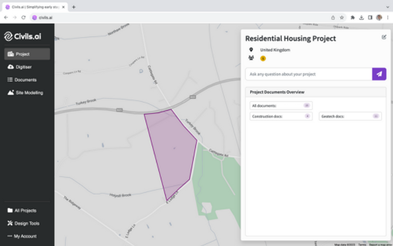
Upload construction documents into civils.ai to activate all the features.Ask questions about your project and instantly pull out information.Extract data from entire PDF geotech reports automatically.--Extract geological description, thicknesses, water level, ground level, test data, coordinates straight from PDFs.--Download extracted data as AGS & Excel.--Access BGS boreholes as AGS and Excel.Build initial 3D site models. Go from raw data to editable 3D models in seconds.--Generate virtual boreholes and explore the subsurface of your site.--Measure bedrock level and identify geotechnical issues.-- Start understanding project risk.Create sections of your site. Draw your cut line on the map.--Create beautifully presented 2D sections.--Edit and control the data being presented.--Download as a PDF and DXF.
In Depth
Civils.ai uses AI for civil engineering calculations and design automation. The platform automates site grading, drainage design, and utility sizing from survey data and design criteria, reducing the manual calculation work in civil engineering.
Tool Details
Corporate (10 users)
More than 30 days
Nomic Use Cases
See how Nomic applies this in production AEC workflows:
Frequently Asked Questions
Upload construction documents into civils.ai to activate all the features.Ask questions about your project and instantly pull out information.Extract data from entire PDF geotech reports automatically.--Extract geological description, thicknesses, water level, ground level, test data, coordinates straight from PDFs.--Download extracted data as AGS & Excel.--Access BGS boreholes as AGS and Excel.Build initial 3D site models. Go from raw data to editable 3D models in seconds.--Generate virtual boreholes and explore the subsurface of your site.--Measure bedrock level and identify geotechnical issues.-- Start understanding project risk.Create sections of your site. Draw your cut line on the map.--Create beautifully presented 2D sections.--Edit and control the data being presented.--Download as a PDF and DXF.
Go from raw data to editable 3D models in seconds.--Generate virtual boreholes and explore the subsurface of your site.--Measure bedrock level and identify geotechnical issues.-- Start understanding project risk.Create sections of your site.
Project Research: Instantly access all project-critical information from a single search interface.