


DroneDeploy
DroneDeploy automates reality capture using drones, robots and 360 cameras, and combines all data in one platform for AI-powered analysis
Definition
01- Set upSync drawings from Procore, Autodesk, Egnyte, Drive or Dropbox in minutes.02- PlanInstantly connect to your compatible 360 cameras via hotspot.03- CaptureMark your starting point and walk the site. The 360 camera takes two photos per second.04- UploadWhen complete, hit upload. Photos are automatically mapped to drawings.
In Depth
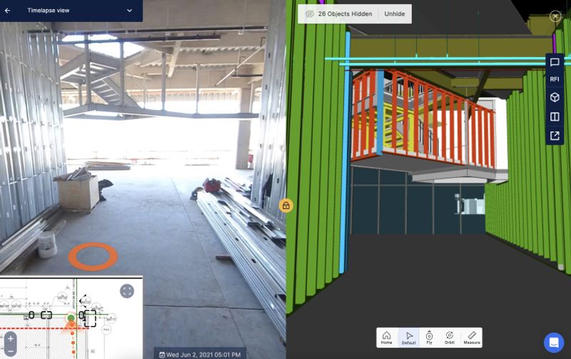
DroneDeploy provides a drone data platform for construction site mapping, progress tracking, and inspection. AI processes the drone imagery to generate site models, measure earthwork quantities, and track construction progress against the schedule.
Tool Details
Individual License
More than 30 days
Frequently Asked Questions
01- Set upSync drawings from Procore, Autodesk, Egnyte, Drive or Dropbox in minutes.02- PlanInstantly connect to your compatible 360 cameras via hotspot.03- CaptureMark your starting point and walk the site. The 360 camera takes two photos per second.04- UploadWhen complete, hit upload. Photos are automatically mapped to drawings.
The 360 camera takes two photos per second.04- UploadWhen complete, hit upload.